


Geoinformatics Solutions for Integrated Agro-ecosystems Research

Sites
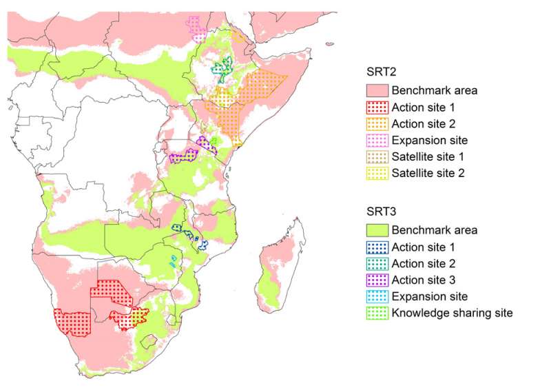
This map shows the Benchmark Areas, Action Sites, Satellite Sites, expansion sites and Knowledge Sharing Sites for the Eastern and Southern Africa Target Region.
The Benchmark Areas were delineated on the basis of two bio-physical criteria: Aridity Index (AI) and Length of Growing Period (LGP). SRT2 areas are defined as having an AI between 0.03 and 0.35 and LGP shorter than 90 days, while SRT3 areas’ AI is between 0.35 and 0.65 and their LGP between 90 and 180 days. It was, however, acknowledged that other factors such as land degradation, climate variability and poverty levels might render an area vulnerable. Based on discussion with stakeholders some areas adjacent to the demarcated SRT2 benchmark area were therefore included in the SRT2 action sites.
Action, Satellite and expansion sites were delineated in a participatory process with stakeholders in a 4-day meeting in Nairobi, 27-30 June 2011.