


Geoinformatics Solutions for Integrated Agro-ecosystems Research
Global Drylands: Moisture Regimes
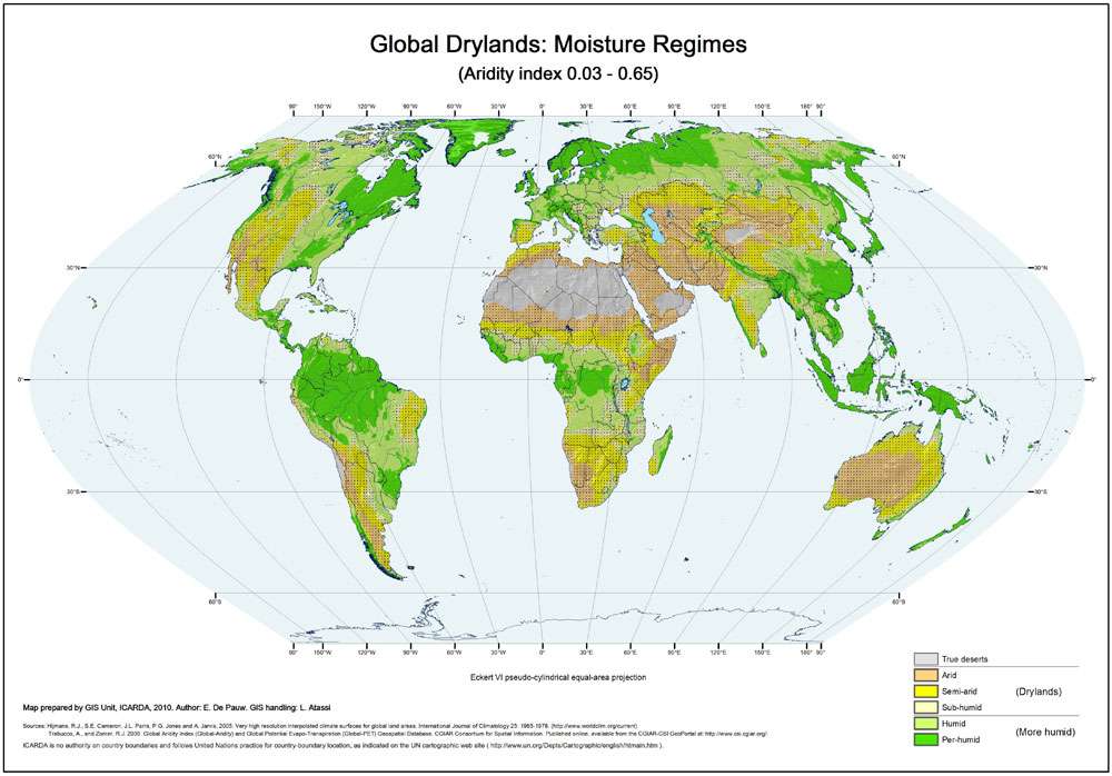
The general moisture regime of the drylands of the world can be expressed by a simple measure, the aridity index (ratio annual precipitation to annual potential evapotranspiration). The following classes are shown on this map:
Hyper-arid: aridity index <0.03
Characterized by very low and irregular rain, which may fall in any season
Arid: aridity index 0.03 – <0.2
Characterized by annual rainfall of 80-200 mm (in areas with winter rainfall) up to 200-350 mm (in areas with summer rainfall). Inter-annual rainfall variability 50-100 percent
Semi-arid: aridity index 0.2 – <0.5
In winter rainfall areas: mean annual rainfall from 200-250 mm to 450-500 mm.
In summer rainfall areas: mean annual rainfall from 300-400 mm to 700-800 mm
Inter-annual rainfall variability 25-50 percent
Sub-humid: aridity index 0.5 – <0.65. Inter-annual rainfall variability is less than 25 percent
Author:
E. De Pauw
Institute:
ICARDA GIS unit
Decription:
The general moisture regime of the drylands of the world can be expressed by a simple measure, the aridity index (ratio annual precipitation to annual potential evapotranspiration). The following classes are shown on this map:
- Hyper-arid: aridity index <0.03
- Characterized by very low and irregular rain, which may fall in any season
- Arid: aridity index 0.03 – <0.2
- Characterized by annual rainfall of 80-200 mm (in areas with winter rainfall) up to 200-350 mm (in areas with summer rainfall). Inter-annual rainfall variability 50-100 percent
- Semi-arid: aridity index 0.2 – <0.5
- In winter rainfall areas: mean annual rainfall from 200-250 mm to 450-500 mm.
- In summer rainfall areas: mean annual rainfall from 300-400 mm to 700-800 mm
- Inter-annual rainfall variability 25-50 percent
- Sub-humid: aridity index 0.5 – <0.65. Inter-annual rainfall variability is less than 25 percent
Source Data:
Hijmans, R.J., S.E. Cameron, J.L. Parra, P.G. Jones and A. Jarvis, 2005. Very high resolution interpolated climate surfaces for global land areas. International Journal of Climatology 25: 1965-1978. (http://www.worldclim.org/current)
Trabucco, A., and Zomer, R.J. 2009. Global Aridity Index (Global-Aridity) and Global Potential Evapo-Transpiration (Global-PET) Geospatial Database. CGIAR Consortium for Spatial Information.
Published online, available from the CGIAR-CSI GeoPortal at: http://www.csi.cgiar.org/ .