


Geoinformatics Solutions for Integrated Agro-ecosystems Research
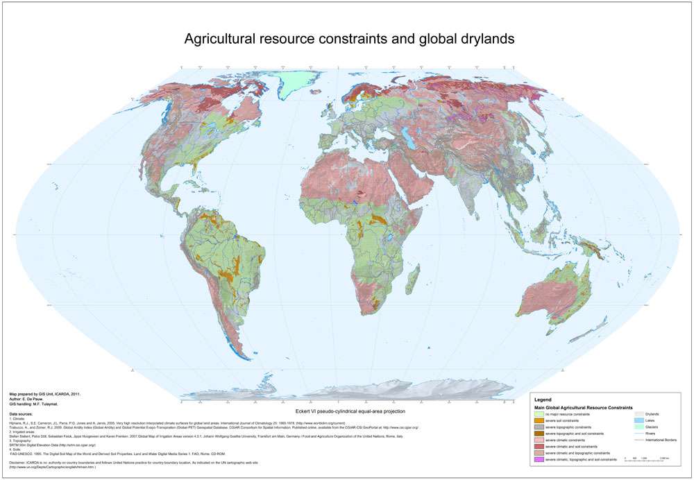
Agriculture resource constraints and global drylands
This map differentiates land according to the presence of key constraints of climate, topography and soils in the following classes:
- No major agricultural resource constraints
- Severe soil constraints: SRPI > 50
- Severe topographic constraints: TRPI > 50
- Severe topographic and soil constraints: TRPI > 50 and SRPI > 50
- Severe climatic constraints: CRPI > 75
- Severe climatic and soil constraints: CRPI >75 and SRPI > 50
- Severe climatic and topographic constraints: CRPI >75 and TRPI > 50
- Severe climatic, topographic and soil constraints: CRPI >75 and TRPI > 50 and SRPI > 50
Author:
E. De Pauw
Institute:
ICARDA GIS unit
Decription:
This map differentiates land according to the presence of key constraints of climate, topography and soils in the following classes:
- No major agricultural resource constraints
- Severe soil constraints: SRPI > 50
- Severe topographic constraints: TRPI > 50
- Severe topographic and soil constraints: TRPI > 50 and SRPI > 50
- Severe climatic constraints: CRPI > 75
- Severe climatic and soil constraints: CRPI >75 and SRPI > 50
- Severe climatic and topographic constraints: CRPI >75 and TRPI > 50
- Severe climatic, topographic and soil constraints: CRPI >75 and TRPI > 50 and SRPI > 50
Note:
CRPI: Climatic Resource Poverty Index
SRPI: Soil Resource Poverty Index
TRPI: Topographic Resource Poverty Index
Source Data:
Climate:
Hijmans, R.J., S.E. Cameron, J.L. Parra, P.G. Jones and A. Jarvis, 2005. Very high resolution interpolated climate surfaces for global land areas. International Journal of Climatology 25: 1965-1978. (http://www.worldclim.org/current)
Trabucco, A., and Zomer, R.J. 2009. Global Aridity Index (Global-Aridity) and Global Potential Evapo-Transpiration (Global-PET) Geospatial Database. CGIAR Consortium for Spatial Information.
Published online, available from the CGIAR-CSI GeoPortal at: http://www.csi.cgiar.org/ .
Irrigated areas: Stefan Siebert, Petra Döll, Sebastian Feick, Jippe Hoogeveen and Karen Frenken. 2007.Global Map of Irrigation Areas version 4.0.1. Johann Wolfgang Goethe University, Frankfurt am Main, Germany / Food and Agriculture Organization of the United Nations, Rome, Italy
Topography: SRTM 90m Digital Elevation Data (http://srtm.csi.cgiar.org/)
Soils: FAO-UNESCO. 1995. The Digital Soil Map of the World and Derived Soil Properties. Land and Water Digital Media Series 1. FAO, Rome. CD-ROM.