


Geoinformatics Solutions for Integrated Agro-ecosystems Research
Outreach
Tools & Apps

GeoAgro Digital Field Data Collection App
First smartphone app (beta) for multiple level field data collection, sharing and data visualization for the agro-ecosystem research, development and outreach. It is a citizen science based crowdsourcing effort to provide a FREE app for the scientific community and citizen science for the georeferenced field data collection, storing and sharing for the research and development. App helps users to share, visualize, and analyze geo-referenced data from various agro-ecosystem around the world.
Please click here to get this tool.
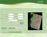
Landsat 8 Tool
This tool enable you to query Landsat 8 data available at Amazon Web Services (AWS) using Path/Row or Latitude/Longitude to select the location scene, you can also define the minimum and maximum cloud cover as well as date (tool will search for the closest date).
You can download all bands in one zip file, or you can select which bands you would like to download. This tool also provides functionality to calculate different indices like NDVI, EVI, and LSWI on fly for the selected scene and date.
Please click here to access this tool.
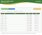
BioComputing Online Service
ICARDA’s BioComputing Online facility has been established a number of computing modules to generate randomized plan for a number of experimental designs and custom made statistical analysis of data commonly arising in agricultural research framework.
A user requests the service by an email providing information on ID of the module of interest, attaches a data text file prepared as per the specified format, containing parameters of the experimental design for which randomized plans are needed, or the datasets for statistical analysis. These data files are analysed using computing codes and the resulting output files are emailed back to the user.
Please click here to access this tool.
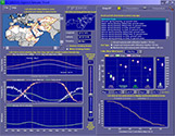
The ICARDA Agro-Climate Tool
The ICARDA Agro-Climate Tool (hereafter 'the application') is a Visual Basic (6) program that can be run on Windows 98, 2000, and XP operating systems. It should be installed on a PC with a Pentium III or better microprocessor and at least 230 Mbytes of available hard disk space. Monitor screen resolution should be at least 1024 X 768 pixels but no more than 1920 X 1440 pixels. Once installed (download here), instructions for the application's use can be found by left single-clicking on 'Instructions'on the application's upper left corner.
The application's primary daily variables (daily minimum temperature, daily maximum temperature, precipitation) were generated by modified GEM6 (Hanson, et al., 1994)weather generator code. Secondary variables (daily dew point temperature, short-wave surface radiation, net outgoing long-wave radiation, and reference grass evapotranspiration) were derived from primary variables using algorithms drawn from the FAO's 'Guidelines for Computing Crop Water Requirements' (Allen et al., 1998). Crop evapotranspiration values were then derived from the reference grass ET values using the FAO-56 single crop coefficient method.
Bibliography
Allen, R.G., Pereira, L.S., Raes, D., and Smith,M. 1998 Crop Evapotranspiration: Guidelines for computing crop water requirements. FAO Irrig. and Drain. Paper No. 56, Food and Agriculture Organization of the United Nations, Rome, Italy. 300p.
(http://www.fao.org/docrep/X0490E/x0490e00.htm)
Hanson, C.L., Cummings, A., Woolhiser, D.A., and Richardson, C.W. 1994. Microcomputer program for daily weather simulation in the contiguous United States. U.S. Department of Agriculture, Agricultural Research Service, ARS-114.
CLIMAP, A Tool for Mapping Climatic Data
Climatic data are usually provided in the form of station data, hence the information is very location-specific. However, in most cases, whether it concerns natural resource management or crop breeding, climatic information is needed for locations away, often quite far, from the climatic stations, or has to be area-specific.
CLIMAP (=CLImate MAPs) was developed to meet this specific need. It is an Excel-based tool that allows to create climatic maps from station data, in the form of GIS raster files that can be imported in all standard GIS software for further processing.
Part of the development of CLIMAP was funded by the ICT-Knowledge Management Program of the CGIAR under the project “Applying ICT and KM for Excellence in Science:
The Consortium for Spatial Information”, which ended in March 2007. Contrary to what this sponsorship might suggest, CLIMAP is not a work of commission.
The first version of CLIMAP was designed in 2000 as a user-friendly interface to the ANUSPLIN interpolation software, in order to address an urgent demand for GIS-compatible climatic maps within ICARDA. As collaborative work with national agricultural research systems in ICARDA’s mandate region necessitated the development of more diverse climatic products, stand-alone modules were added to meet specific needs.
CLIMAP can be considered an example of ad-hoc, user-driven, incremental software development with the advantages and drawbacks of such strategy: modular plug-in design, low cost, immediate use, but also leading to an incomplete system with much scope for improvement.
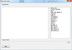
ArcGIS Multi-line Raster Calculator
The Raster Calculator provides you a powerful tool for performing multiple tasks. You can perform mathematical calculations using operators and functions, set up selection queries, or type in Map Algebra syntax. Inputs can be raster datasets or raster layers, coverages, shapefiles, tables, constants, and numbers.
When ESRI launched its 10th version of ArcGIS, they limited the Raster Calculator to evaluate only one line expression, and for some users, Raster Calculator was used as a kind of automation script to perform, many steps at one, so we implemented a Multi-line Raster Calculator which gives user the ability to perform multi-line expressions.
Tool developed using ArcGIS Runtime SDK for .Net framework and compatible with ArcGIS 10.x.
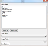
ArcGIS Clip Tool
This tool provides easy way to clip multi layers based on specific mask, the tool advantage is that it accepts both feature and raster layers and call the appropriate built in tool, then exports all results into one folder.
Tool developed using ArcGIS Runtime SDK for .Net framework and compatible with ArcGIS 10.x.
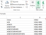
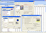
Crop Pedigree Recording (CPR) Excel Macro: F1 Crosses & Fn+1 Selection
Excel Macro Add-In to Generate F1 Crosses and Fn+1 Selection Pedigree Names (version 4.6)
Sometimes breeders may buy and install complicated software to automate simple tedious task like naming F1 crosses using a standardized pedigree recording system starting from parents’ names. Others may do similar task manually which might results into typing errors. This is a customized Excel macro developed to automate the task of pedigree recording implemented in a popular Excel spreadsheet environment.
Please contact us to get this Excel macro. You may also find the related user manual here.

Julian Day Calendar
Julian day calendar for calculating actual date (Gregorian calendar) for satellite pass or image acquisition date, for example finding a date of image acquisition of MODIS Surface Reflectance Images at 8-days interval (MOD09a1).
Please click here to access this tool.