


Geoinformatics Solutions for Integrated Agro-ecosystems Research
Research
Social, Economic & Policy Research Program
Poverty/ livelihoods analysis and impact assessment
In view of the importance of the natural resource base as a factor contributing to poverty in CWANA, the GISU developed, in association with the SEPR, an index-based method to map 'agricultural resource poverty' and the 'agricultural resource endowment' of different areas in CWANA (Fig. 7) on the basis of climatic, terrain, soil and land use data at 1-km resolution.
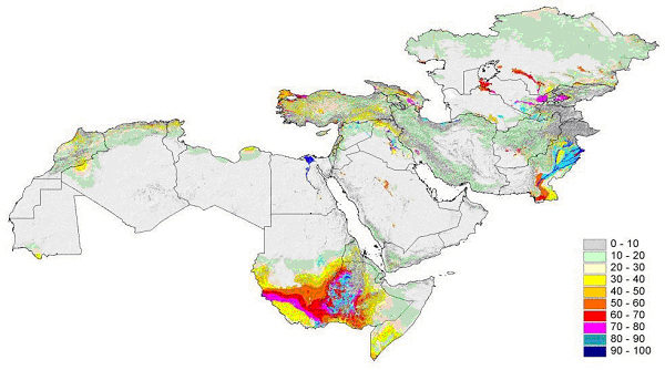
Fig. 7. Agricultural Resource Potential Index for CWANA (scale 0-100; 100 best)
This method, based on the concept of Agricultural Resource Potential Index (ARI), was used for mapping agricultural incomes in Syria (Fig. 8).
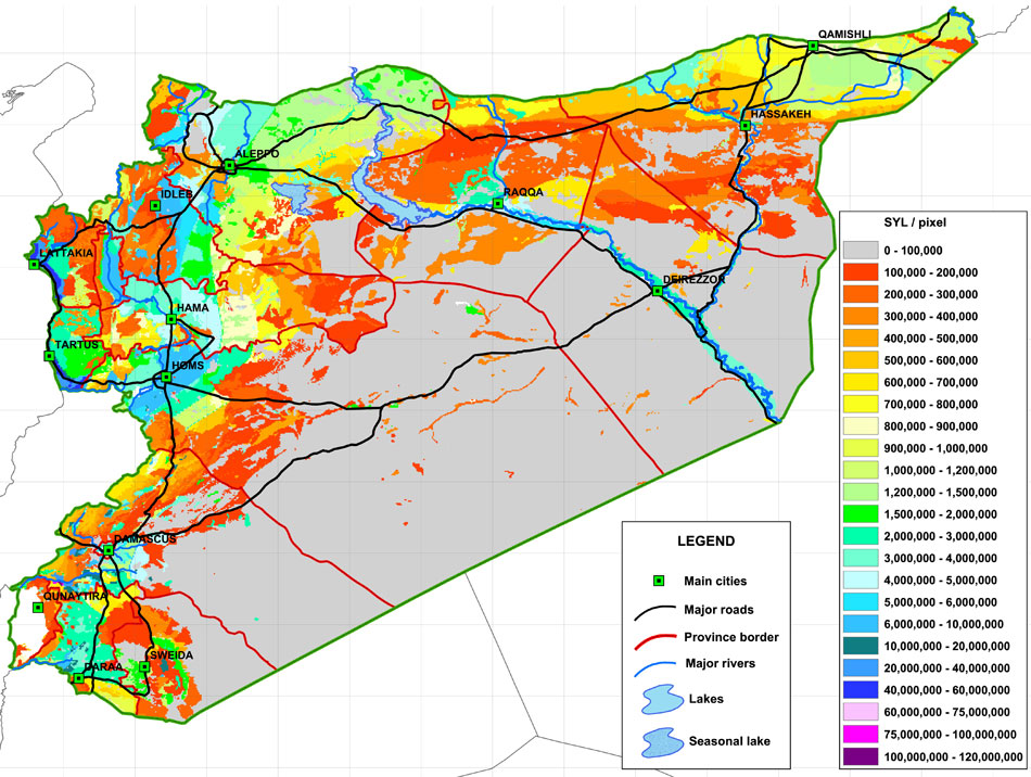
Fig. 8. Resource-based disaggregated distribution of total income from agriculture and livestock
Plans are underway to apply the method to other parts of CWANA as well, and to extend the ARI index mapping to all developing countries in order to allow a simple but objective comparison of resource potential.
While the ARI-method is fairly scale-independent, a proper understanding of poverty at household levels also requires knowledge about the land and water resources that households have access to. To this effect the GISU has developed a participatory approach, involving farmers and land users, aimed at capturing local agroecological knowledge (Fig.9). In collaboration with MP5 these approaches will be applied in poverty studies in different parts of Northwest Syria.
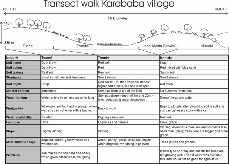
Fig. 9. Example of a participatory resource-based transect walk, Karababa, NW Syria