
Agricultural Monitoring in Yemen
Please select a product line
Map Information
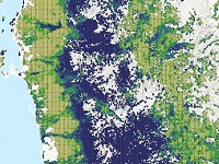
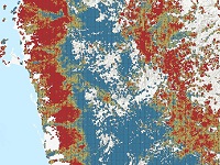
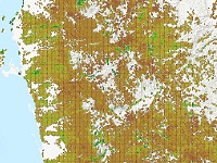
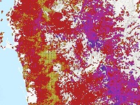
The conflict in Yemen has escalated since 2015 and lasts until 2018. According to FAO, fighting in Yemen had
a massive impact on agricultural areas. The agriculture sector is among the worst hit by the current crisis
and local food production has been severely compromised. This set of maps analyses conflict related damage on
agriculture. The map was created by ICARDA for World Bank.
Data Sources
Inset maps based on:
- Thematic layer: ICARDA (2018)
- Administrative boundaries (DIVA-GIS 2018)
- Hydrology, Settlements, Transportation (Natural Earth, 2018)
- Cropland (Global Food Security-support Analysis Data GFSAD, 2015) satellite image backdrop (Sentinel-2 cloudless – https://s2maps.eu by EOX IT Services GmbH – Contains modified Copernicus Sentinel data 2016 & 2017)
Disclaimer
The products elaborated in the framework of this project are realized to the best of our ability, optimizing
the available data and information. All geographic information has limitations due to scale, resolution, date
and interpretation of the original data sources.