


Geoinformatics Solutions for Integrated Agro-ecosystems Research
Research
Water, Land Management & Ecosystems Program
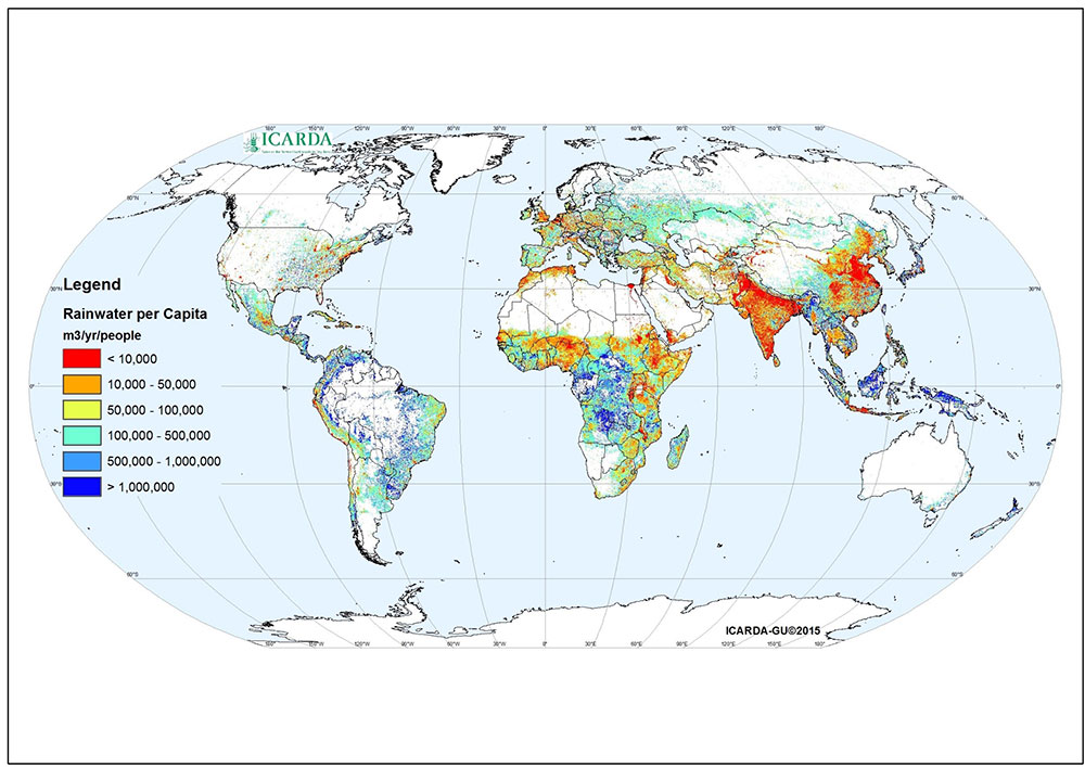
Availability of Green Water (Precipitation) per Capita (m3/yr/people in km2)
To assist the targeting of water saving technologies, the GISU is developing, in association with the IWLMP, methodologies for assessing the biophysical potential for water harvesting and supplemental irrigation. Map products are currently available for Syria (Fig. 1) but outscaling to the level of all dryland areas is planned in the case of micro-catchment water harvesting techniques.
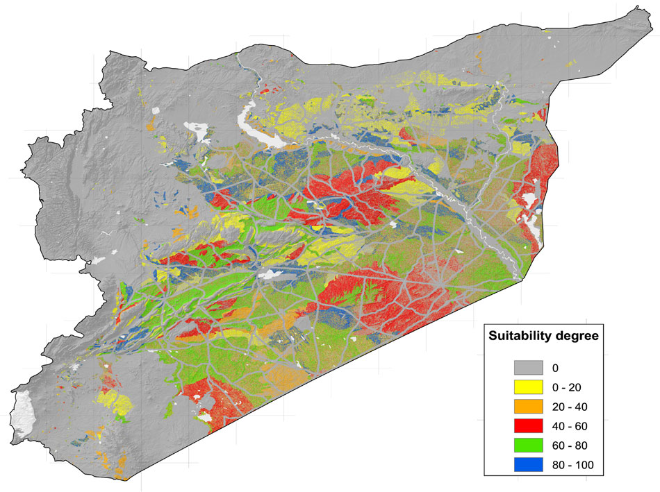
Fig.1. Suitability for water harvesting in Syria, micro-catchment systems, small-runoff basins, tree crops
In collaboration with the Plant Stress and Water Conservation Laboratory of the USDA Agricultural Research System in Lubbock, Texas, a geospatial tool, the ICARDA Agroclimate Tool, was developed, which predicts the risk of climatic stress (drought, heat,cold) for specific environments in CWANA (Fig.2).
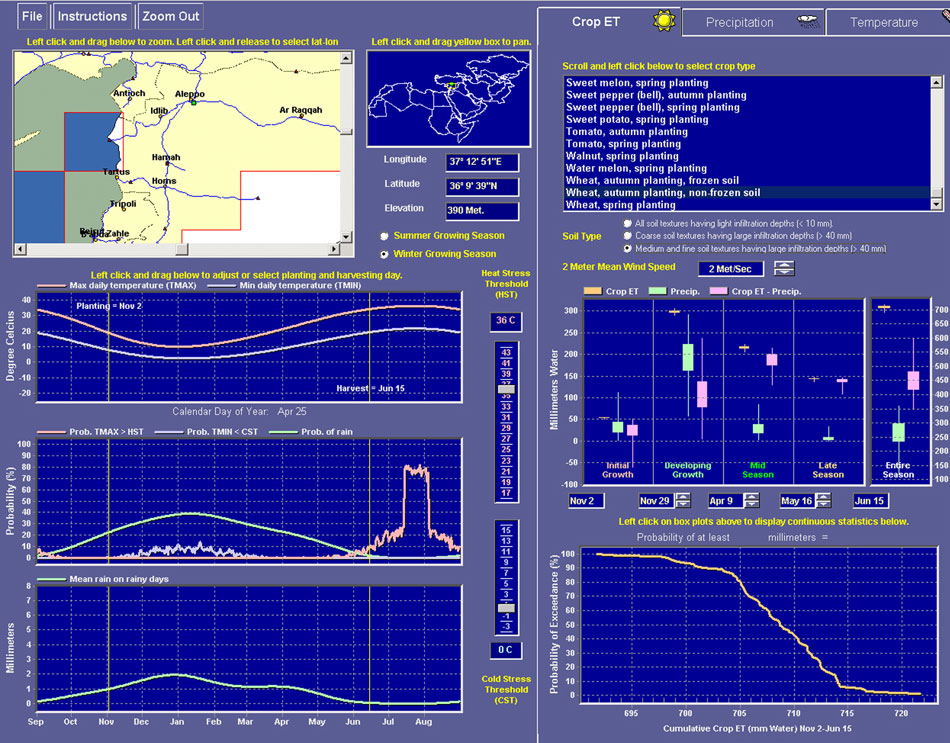
Fig. 2. Graphical user interface of the ICARDA Agro-Climate Tool
To deal with the challenge of assessing land degradation in dryland areas, the GISU has used remote sensing for detecting large-scale land use changes in the CWANA region. Areas with significant land use/land cover change were identified from the Advanced Very High Resolution Radiometer (AVHRR) Pathfinder for the period 1982-1999 (Fig. 4), using a 'hot-spot' approach. Future remote sensing studies will investigate whether any change trends are associated with land degradation.

Fig. 4 Change map indicating which parts of West Asia showed intensification or extensification trends in the period 1982-1999