


Geoinformatics Solutions for Integrated Agro-ecosystems Research
GIS Data
Maps in: Agro-Ecological Zoning

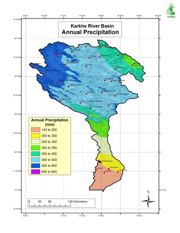
Annual Precipitation in Karkheh River Basin
Mean annual precipitation in Karkheh river basin for the period 1973-1998
Metadataclose[x]
Annual Precipitation in Karkheh River Basin
Generate successively an aridity index map, an agroclimatic zones map and eventually an agro-ecological zones map for the Karkheh River Basin
Mean annual precipitation in Karkheh river basin for the period 1973-1998
International Center for Agricultural Research in the Dry Areas (ICARDA)
2008
precipitation, agroclimatic zones
Iran, Karkheh river basin
46.100529
49.162195
34.960947
30.953447
D_WGS_1984
WGS_1984
6378137.000000
298.257224

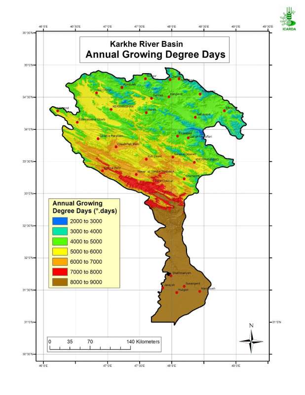
Annual Growing Degree Days in Karkheh River Basin
Annual growing degree-days in Karkheh river basin
Metadataclose[x]
Annual Growing Degree Days in Karkheh River Basin
Characterisation of agricultural climates of the Karkheh River Basin
Annual growing degree-days in Karkheh river basin
International Center for Agricultural Research in the Dry Areas (ICARDA)
2008
annual growing degree days, agricultural climates
Iran, Karkheh river basin
46.100529
49.162195
34.960947
30.953447
D_WGS_1984
WGS_1984
6378137.000000
298.257224

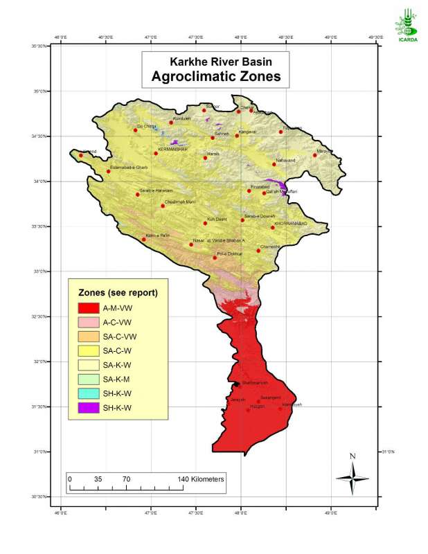
Agroclimatic Zones in Karkheh River Basin
Agroclimatic zones in Karkheh river basin
Metadataclose[x]
Agroclimatic Zones in Karkheh River Basin
Generate an agro-ecological zones map for the Karkheh River Basin along with land use/land cover and soil/landforms layers.
Agroclimatic zones in Karkheh river basin
International Center for Agricultural Research in the Dry Areas (ICARDA)
2008
agroclimatic zones
Iran, Karkheh river basin
46.100529
49.162195
34.960947
30.953447
D_WGS_1984
WGS_1984
6378137.000000
298.257224

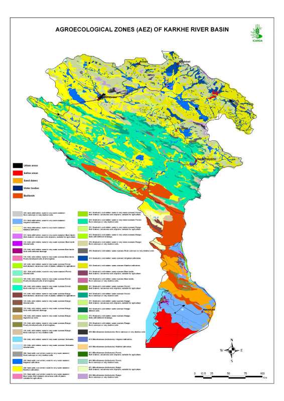
Agro-Ecological Zones in Karheh River Basin
Agro-ecological zones in Karkheh river basin
Metadataclose[x]
Agro-Ecological Zones in Karheh River Basin
Characterization of the agricultural environments in the Karkheh river basin based on water availability, climate, terrain and soil conditions.
Agro-ecological zones in Karkheh river basin
International Center for Agricultural Research in the Dry Areas (ICARDA)
2008
agro-ecological zones, agricultural environments
Iran, Karkheh river basin
46.104568
49.164568
34.953779
30.968779
D_WGS_1984
WGS_1984
6378137.000000
298.257224